...Tropical Storm Arthur becomes the first named storm of the 2026 Atlantic hurricane season, bringing flood and storm surge concerns to the Gulf Coast... Texas activated emergency resources and disaster declarations as heavy rainfall threatened widespread flooding... Oregon declared a statewide emergency due to elevated wildfire risk from extreme heat and dry conditions... A Washington wildfire forced 1,500 evacuations and destroyed multiple homes... A Nebraska wildfire burned more than 23,000 acres, prompting evacuations and a state emergency declaration... NOAA officially declared El Niño conditions, expected to influence weather patterns and disaster risks across the U.S...
Disaster Management Simplified
Streamlined solutions for emergency management.
Recover Faster
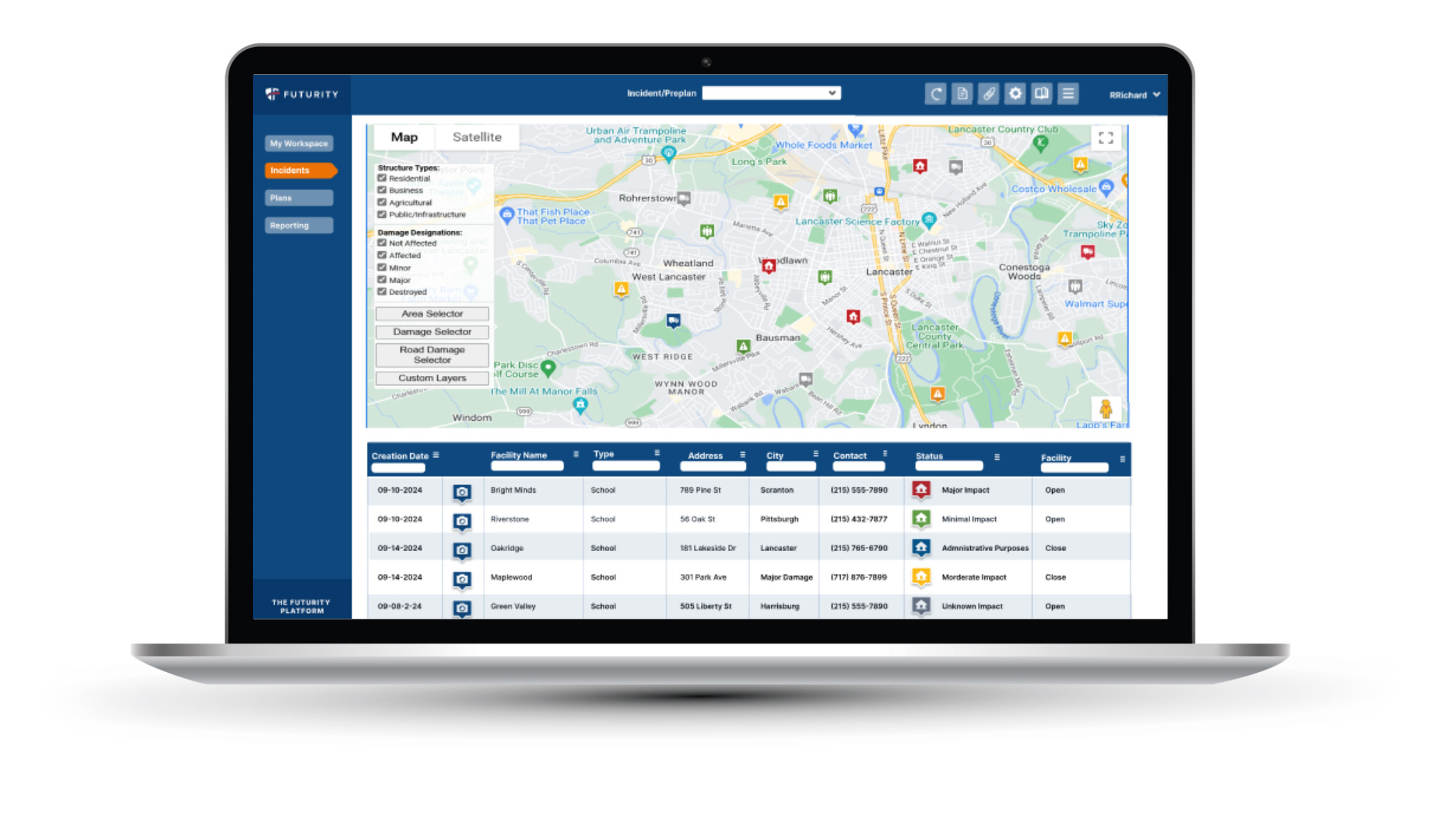
Emergency managers have access to real-time data for damage assessment and to streamline FEMA reporting.
SEE CASE STUDY
Enhance Mass Care Response
Optimize Mass Care efforts with rapid survivor needs assessments, proactive reporting, and smooth transitions into Disaster Case Management, ensuring no critical need is overlooked.
SEE CASE STUDY
Orion is Now The Futurity Platform
The Orion product name has changed to The Futurity Platform. The new platform encompasses the full scope of disaster management.
Understand the big picture with an intuitive, mobile-enabled technology platform. Address emergencies and disasters in real-time, support people and communities impacted, and gain powerful insights to mitigate future events.
We currently serve in 32 states.
From the Field
“We have used the Orion Software (The Futurity Platform) to collect damage assessment data for seven federally desclared disasters, including two hurricanes that affected Alabama. The Futurity Platform has proven to be an intuitive system for our end users and easy to deploy and conduct just-in-time training for new users to the software and the damage assessment process.”
STATE OF ALABAMA
“The training sessions provided by Futurity were exceptional. Recognizing the significant of in-person training for our counties and state staff, The Futurity Platform training team went above and beyond by scheduling three trips, totaling nine days, encompassing 18 distinct training sessions. The positive feedback we received from our emergency managers following these sessions underscored their effectiveness.”
STATE OF KANSAS
“The Futurity Platform was utilized for damage assessments after a freak hailstorm in Wallowa County damaged many homes. The system received extremely positive reviews from those using the app to conduct damage assessments with feedback that it enabled a very easy-to-follow and efficient process. Furthermore, Futurity’s dedicated staff worked tirelessly to ensure a timely data upload, allowing us to include every ODHS structure in our report to Oregon’s governor.”
STATE OF OREGON
Orion is Now the Futurity Platform
We are thrilled to announce that our Orion Solution has evolved into the Futurity Platform, reflecting our enhanced software capabilities and expanded offerings.
Preparation is essential for success. Our platform supports your team with planning and execution capabilities that maximize GIS and mobile technology to ensure that everyone is ready to respond effectively during an emergency.
Streamlined process for planning and documentation.
Common Operating Picture
Visualize and analyze critical data related to transportation, health, and emergency management, allowing better decision-making and response.
Mobile Reporting
Features technology for mobile device usage from the field, collecting data and collaborating with the entire team.
Advanced Communication & Notification Systems
Real-time alerts and updates to keep everyone informed.
Assess, Respond, Recover
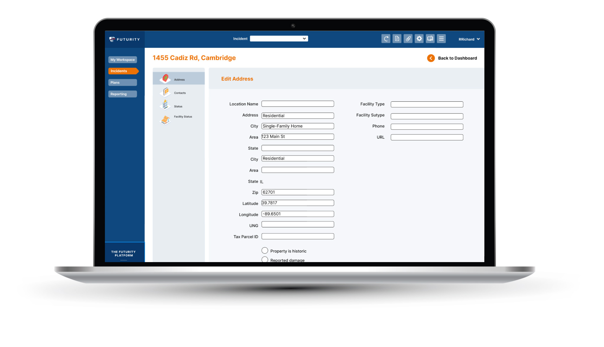
Damage Assessments (IA and PA)
Streamlined system to assess damage to private and public property.
Resource Management
Efficient tracking and allocation of resources.
Data Collection & Analysis
Tools for gathering and analyzing data on available resources and team preparedness.
GIS Mapping
Collects critical data with real-time collaboration.
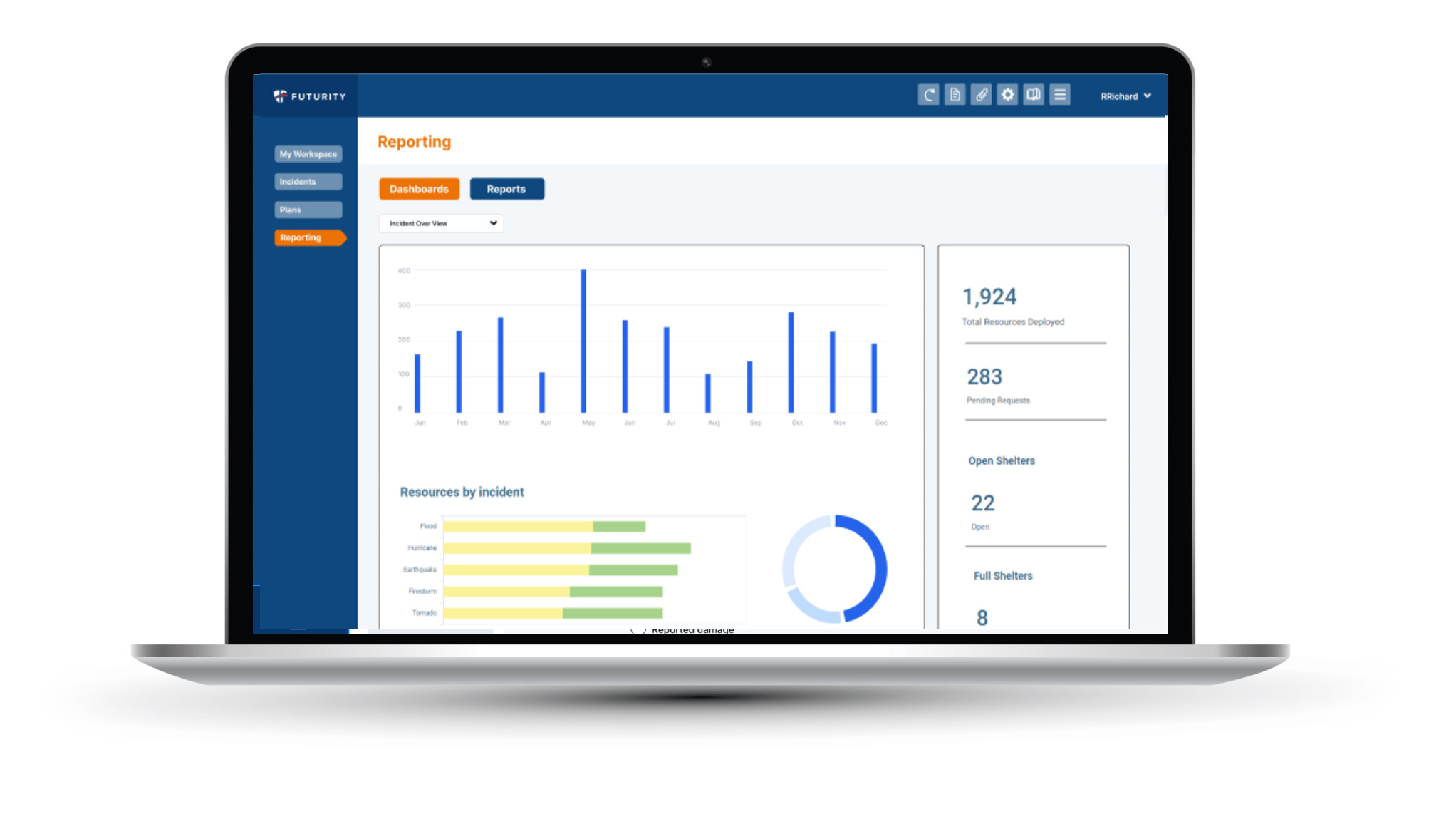
Data Visualization & Comprehensive Reporting
Streamlines government reporting processes, saving time and resources while ensuring compliance with regulations.
Search & Rescue
Real-time capabilities help document a victim’s location and determine a safe action plan for rescue.
Mass Care Functionality
Comprehensive support for sheltering, disaster case management, and individual needs assessment.
Lifelines
Features to record and track safety and security, food and potable water, shelter, health and medical, hazardous materials, energy, communications, transportation, and water systems.
Reporting and Preparedness
FEMA Reporting
The required daily reports are generated through our platform and sent to FEMA for quicker turn-around to receive federal aid.
Public Self-Reporting
Our system allows initial damage information to come through public self reporting and can be reviewed, updated, and validated.
Scalability & Flexibility
Ability to adapt to incidents of varying sizes and types.
Off-Line Capabilities
Systems work with or without cell service.
Training & Simulation Tools
Features to conduct exercises and drills to ensure team readiness.
User-Friendly Interface
Easy-to-use platform for quick adoption and efficient operation.
The Futurity Difference
Managing disasters is difficult. Futurity simplifies it by:
Leading with intuitive technology
Streamlining your team collaboration quickly
Supporting your team with trainings & simple FEMA reporting